
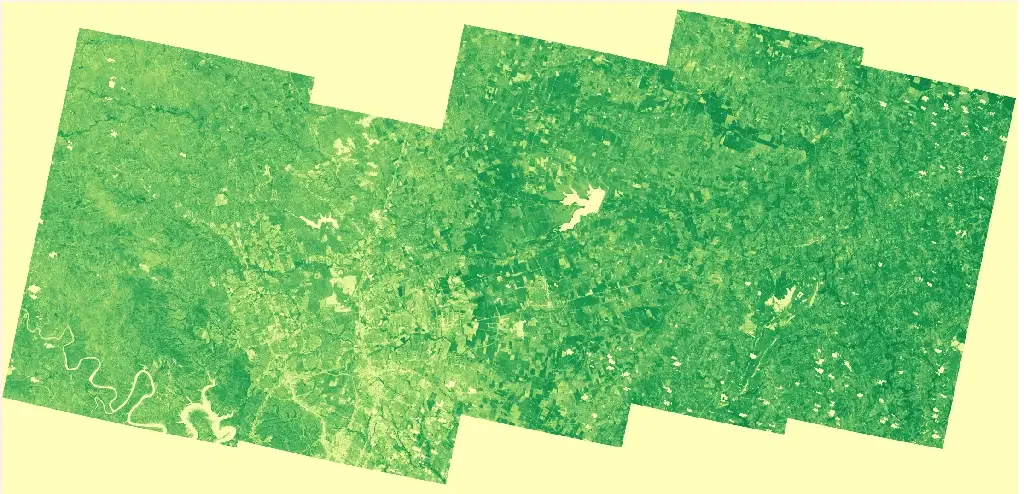
Planet Normalized Difference Vegetation Index (NDVI)
Summary
Normalized Difference Vegetation Index (NDVI) is calculated as (NIR - Red)/(NIR + Red), where NIR is near-infrared reflectance and Red is visible red reflectance. For PlanetScope, NDVI is calculated from the near-infrared and red bands of the Dove and SuperDove sensors. NDVI values generally range from -1 to 1, with higher positive values associated with dense, healthy green vegetation and lower or negative values associated with sparse vegetation, bare surfaces, water, snow, clouds, or other non-vegetated areas. The high spatial resolution and frequent revisit of the PlanetScope constellation make this product well suited to mapping vegetation condition at the scale of individual fields, parcels, and riparian corridors. NASA-supported access to Planet commercial satellite imagery is provided through NASA's Commercial Satellite Data Acquisition (CSDA) Program.
Suggested Use
Planet NDVI can be used to assess vegetation condition and identify changes to vegetated surfaces before and after natural hazards. Changes in NDVI can help characterize vegetation loss, stress, or recovery associated with flooding, wildfire, severe weather, drought or heat impacts, and other disturbances. NDVI should be interpreted together with other imagery and environmental information because vegetation type, seasonality, atmospheric conditions, soil background, and surface moisture can influence observed values. Clouds, smoke, and haze may obscure the surface in individual scenes.
Terms of Use
NASA data and products are freely available to federal, state, public, non-profit and commercial users. This information can be experimental- or research-grade data products and may not be appropriate for operational use. These NASA data products, services, and the Disasters Mapping Portal are intended to aid decision makers and enhance situational awareness, but these data are not guaranteed to be consistently available or routinely updated. Use of this product should include: 'Includes copyrighted material of Planet Labs PCB. All rights reserved.'
Satellite/Sensor
PlanetScope Dove and SuperDove optical satellite constellation operated by Planet Labs PBC
Resolution
Approximately 3 meters
Credits
Planet Labs PBC; NASA Commercial Satellite Data Aqcuisition (CSDA) Program; NASA Disasters Program
©2026 Planet Labs PBC. All rights reserved.
This work utilized data made available through the NASA Commercial Satellite Data Acquisition (CSDA) Program.
Tags
NASA, CSDA, Planet Labs, PlanetScope, Dove, SuperDove, Commercial Satellite Data, NDVI, Normalized Difference Vegetation Index, Vegetation, Optical