
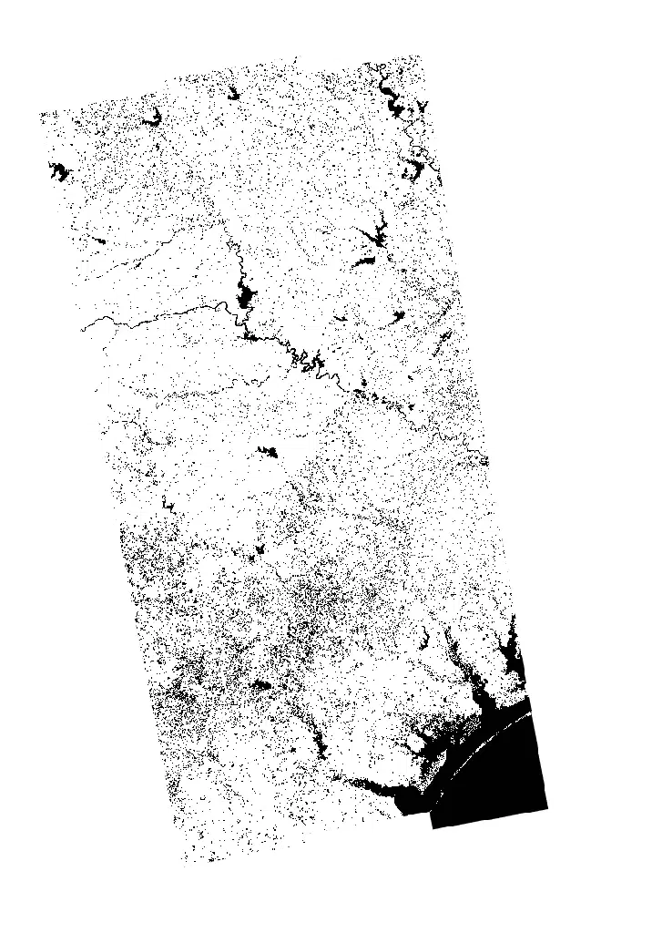
OPERA Dynamic Surface Water Extent (DSWx)
Summary
The OPERA Dynamic Surface Water Extent (DSWx) product suite maps where water is present at the land surface. It is produced in two forms that complement one another. DSWx-HLS is derived from Harmonized Landsat Sentinel-2 (HLS) optical observations and offers frequent coverage wherever skies are clear. DSWx-S1 is derived from Sentinel-1 C-band synthetic aperture radar, which penetrates cloud and operates day or night, so it can map water during the overcast conditions that typically accompany a flood.
Products are distributed both as a classified water extent layer (WTR), which distinguishes open water from partial surface water and flags cloud, cloud shadow and snow or ice, and as a binary water layer (BWTR), which reduces the classification to water and not-water for quick interpretation. For some disaster events, DSWx observations are also used to produce change maps comparing water extent between acquisition dates; these are represented here as part of the broader DSWx product suite rather than as a separate data product.
Suggested Use
DSWx supports flood extent mapping and the monitoring of open water before, during and after an event. Comparing an observation against a pre-event baseline identifies inundated areas and helps estimate the footprint of flooding for response planning and damage assessment. The two sensors are best used together: the radar-derived product provides observations through cloud cover during the event itself, while the optical product contributes higher-frequency context and recovery monitoring once skies clear.
Some caution is warranted in interpretation. Optical products cannot see the surface beneath cloud, and those pixels are flagged rather than classified. Radar-derived water detection can be confounded by terrain shadow, very smooth dry surfaces such as bare sand or paved areas, and dense vegetation canopy overlying standing water. Results should be read alongside true colour imagery and other observations rather than on their own.
Terms of Use
NASA data and products are freely available to federal, state, public, non-profit and commercial users. This information can be experimental- or research-grade data products and may not be appropriate for operational use. These NASA data products, services, and the Disasters Mapping Portal are intended to aid decision makers and enhance situational awareness, but these data are not guaranteed to be consistently available or routinely updated. Use of this product should include: 'Contains modified Copernicus Sentinel data (2026) processed by ESA.'
Satellite/Sensor
Operational Land Imager (OLI) on Landsat 8 and 9 and MultiSpectral Instrument (MSI) on the European Space Agency's Copernicus Sentinel-2 satellites, combined as Harmonized Landsat Sentinel-2 (HLS); and C-band Synthetic Aperture Radar (SAR) on the Copernicus Sentinel-1 satellites
Resolution
30 meters
Credits
NASA Jet Propulsion Laboratory, California Institute of Technology; NASA OPERA; USGS; ESA Copernicus; NASA Disasters Program
Use of this product should include: “Contains modified Copernicus Sentinel data (2022-2026) processed by ESA”
Tags
NASA, OPERA, DSWx, DSWx-HLS, DSWx-S1, Dynamic Surface Water Extent, Surface Water, Flood, Inundation, Landsat, Sentinel-1, Sentinel-2, HLS, SAR, Synthetic Aperture Radar