
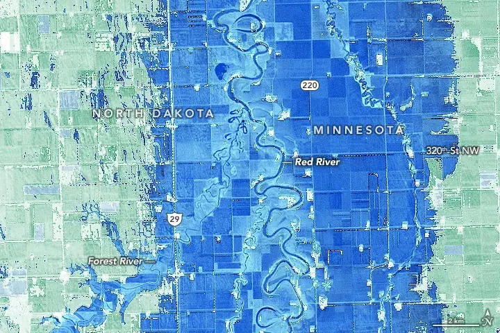
Landsat Modified Normalized Difference Water Index (MNDWI)
Summary
Modified Normalized Difference Water Index (MNDWI) is calculated as (Green - SWIR)/(Green + SWIR), where Green is visible green reflectance and SWIR is shortwave-infrared reflectance. For Landsat 8 and Landsat 9, MNDWI is commonly calculated using Operational Land Imager (OLI) Band 3 for green and Band 6 for shortwave infrared. The index is designed to enhance open water features while reducing the influence of vegetation, soil, and built-up surfaces.
Suggested Use
Landsat MNDWI can be used to identify and map open water and changes in surface water extent associated with flooding, tropical cyclones, severe storms, and other hydrologic events. Positive MNDWI values are generally associated with water, while lower or negative values are more commonly associated with vegetation, bare ground, and developed surfaces. Thresholds may vary by location and environmental conditions, so MNDWI should be interpreted together with supporting imagery and local context.
Terms of Use
NASA data and products are freely available to federal, state, public, non-profit and commercial users. This information can be experimental- or research-grade data products and may not be appropriate for operational use. These NASA data products, services, and the Disasters Mapping Portal are intended to aid decision makers and enhance situational awareness, but these data are not guaranteed to be consistently available or routinely updated.
Satellite/Sensor
Operational Land Imager (OLI) and Operational Land Imager-2 (OLI-2) aboard the NASA/USGS Landsat 8 and Landsat 9 satellites
Resolution
30 meters
Credits
NASA, U.S. Geological Survey (USGS)
Tags
NASA, USGS, Landsat, Landsat 8, Landsat 9, OLI, OLI-2, MNDWI, Modified Normalized Difference Water Index, Surface Water, Flooding