
WB-57 DyNAMITE Airborne Imagery
Summary
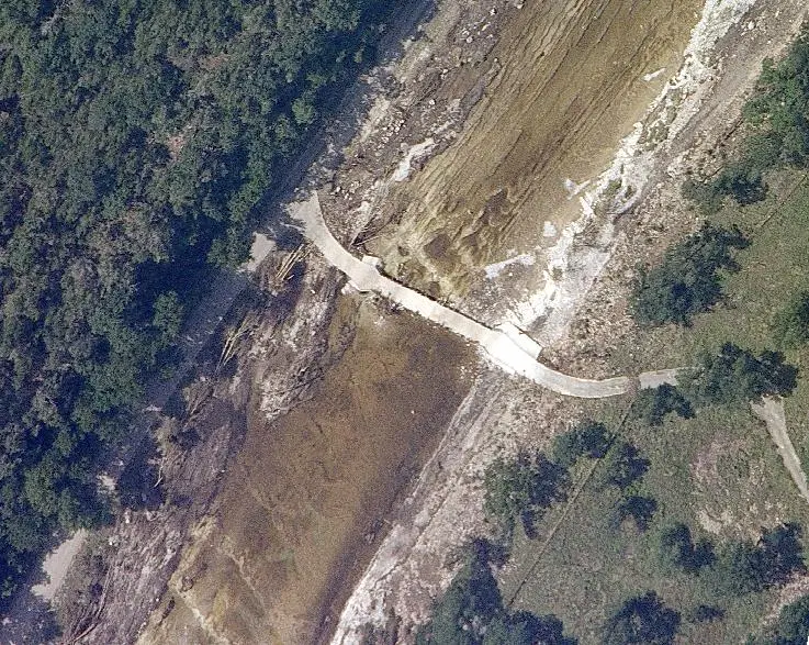
NASA WB-57 aircraft, outfitted with the DyNAMITE camera, is a high altitude, reconnaissance asset with the ability to collect 10cm imagery from 50,000 ft. Originally designed to monitor NASA Space Shuttle launches and reentry, DyNAMITE can collect small-footprint visible RGB or mid-wave infrared (MWIR) images over a wide area or livestream full motion video over the Internet through a web browser.
High resolution visible (RGB) and mid-wave infrared (MWIR) images acquired around point targets. Several photos are taken around each target; continuous monitoring can be achieved by maintaining an orbital track around the target of interest. Data may be delivered as individual oriented images or as orthomosaiced GeoTIFFs covering the area around the target. This tool is not optimized for wide area strip map/swath imaging. Resolution and image footprint vary with altitude and selected focal length. Can support multiple mission profiles, such as Full Motion Video (FMV) missions with near real-time tasking; and pre-planned target deck missions for point targets.
Terms of Use
NASA data and products are freely available to federal, state, public, non-profit and commercial users. This information can be experimental- or research-grade data products and may not be appropriate for operational use. These NASA data products, services, and the Disasters Mapping Portal are intended to aid decision makers and enhance situational awareness, but these data are not guaranteed to be consistently available or routinely updated.
Suggested Use
The imagery can be used to identify individual structures, debris fields, and flood boundaries along river corridors, at a level of detail that satellite imagery cannot resolve. During the July 2025 Central Texas floods, NASA streamed live video feeds and imagery directly to responders while the flights were still in the air.
Frames are collected through gaps in the clouds rather than as continuous coverage, so availability varies across an area of interest.
Satellite/Sensor
DyNAMITE, a nose-mounted visible and infrared imager aboard NASA's WB-57 high-altitude aircraft, operated by NASA's Johnson Space Center
Resolution
10 cm. Spatial resolution and footprint size are dependent on focal length and altitude.
Credits
NASA Johnson Space Center, NASA Disasters Program
Tags
NASA, WB-57, DyNAMITE, Airborne, Visible, Infrared, MWIR, High Resolution, Flood, Disaster Response